
INSIGHTS - Around Wollumbin Mt Warning Photo-trail
A 'close up and personal' view of the northern and western sides of the summit:
A 'close up and personal' view of the northern and western sides of the summit:
Footage courtesy of Graeme Cooney - Caldera Productions
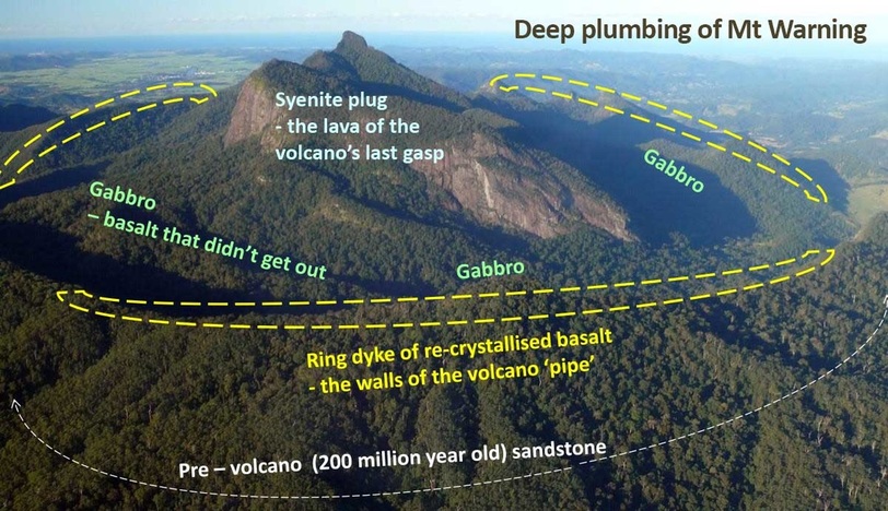
While we are having an 'intimate' view of the western side of the summit, here is an interesting geological interpretation, remembering that the mountain we see now was once a kilometre under the top of the active volcano.
Murwillumbah can be seen in the distance to the left of the rock-face
Murwillumbah can be seen in the distance to the left of the rock-face
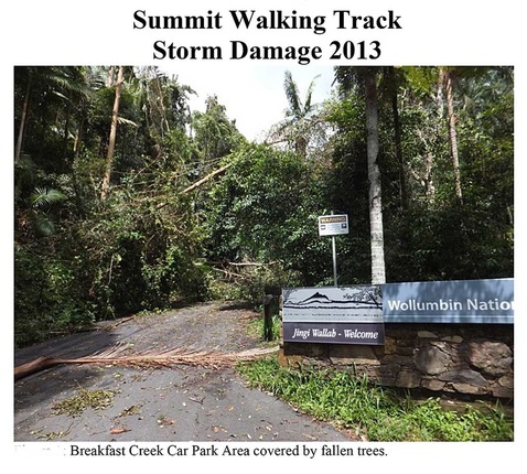
Link to Wollumbin National Park storm damage January 2013 - ex tropical cyclone Oswald pdf
The park was closed for 8 months until major repairs to the summit track were completed
As a result, a study by Southern Cross University was conducted to find possible alternative 'adventure' walks.
No outcomes have been achieved to date although a Tweed-Byron Hinterland overnight walk is in the pipeline.