
Self-drive Photo-trails
Photo-trails are self-drive touring routes, from half day to full day and overnight expeditions in and around the Tweed region.
Note: Wollumbin National Park (including the summit track) is closed until further notice
All have been thoroughly researched to provide visitors (and locals) the best opportunities for roadside sightseeing. From serious photographers to ‘selfie’ snappers, you are invited to experience the ‘top spots’ that many of our landscape artists use as inspiration. These places are marked on our maps (not on the actual roadside). Murwillumbah is geographically at the centre of the Tweed Shire and the trails spread from the Murwillumbah Visitors Centre.
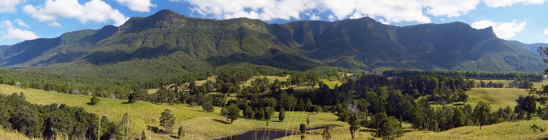
Border Ranges, from Brays Creek (Around Wollumbin Mt Warning PhotoTrail) - Phil Lomas photo
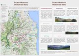
The map below has all ten colour coded Photo-trails. Several now have their own page with interactive maps, images and insights. The other Photo-trails are still 'work in progress'.
Map can be ENLARGED or re-positioned (PAN) with your device
Also, top left icon opens the Photo-trails menu then 'click' onto the coloured routes for details AND top right icon opens Google Maps enlargement
|
|
Best times to be out there exploring?
In the Tweed region (a sub-tropical climate) the 'wet' season is usually between the months of November and April when it can be somewhat warm and humid. Visibility varies from day to day but the bonus is the possibility of spectacular late afternoon storms to add drama to the landscape. The winter months usually offer clear distant views with vibrant colours and strong light contrasts.
Early morning starts are often rewarded with clearer, sharper light with rich golden hues and deep contrasting shadows. From mid-morning through to mid-afternoon the light is generally brighter but can wash out the colours.
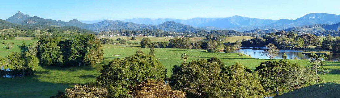
View from Tweed Regional Gallery to Wollumbin Mt Warning, distant Border Ranges and Springbrook Plateau - AR photo
Photo-trail Place Name Derivations *
Each of the Photo-trail pages will include historical insights to the naming of villages, towns, mountains, rivers and other localities.
Each of the Photo-trail pages will include historical insights to the naming of villages, towns, mountains, rivers and other localities.
|
TWEED RIVER
MURWILLUMBAH WOLLUMBIN MT. WARNING |
Named by explorer John Oxley in 1823 after the River Tweed, the boundary between England and Scotland.
Name recorded by Joshua Bray on his arrival in 1863 as the Aboriginal name for the local tribe and lands, the Moorung Moobar. The name has been transcribed with various meanings : ‘place of many possums, many people”, or ‘good camp site’ or 'big nose (referring to rocky headland opposite Budd Park). Gazetted as a town in 1879. Aboriginal name for Mt Warning. A spiritual place meaning 'cloud catcher' or 'fighting chief of the mountains'. Not to be confused with Mt Wollumbin, now officially an unnamed peak, 2km to the north east of the summit. Wollumbin was declared a sacred place (above 600 metres in elevation) for the Bundjalung people in 2015. In 1770, sighted by Lieutenant James Cook (as he was then) when sailing past (and naming) Byron Bay. Subsequently naming it after having escaped dangerous reefs off Pt Danger (or possibly Cook Is.) and hence serving as a warning to future mariners. *Source: Place Names of the Tweed and Brunswick Regions - Richmond Tweed Regional Library 1984 |
Header image: Sunrise over the Tweed Valley, from Pinnacle Lookout, Border Ranges National Park (Photo-trail pending) - Lindy Treasure photo